Street Lookup
The Street Lookup function allows you to pre-map common streets in your area so you can assign them to delivery zones. Delivery zones are used in marketing and allow you to group areas together for tracking purposes.
The Street Lookup screen is presented in a spreadsheet style format and allows you to see all your entered streets at a glance.
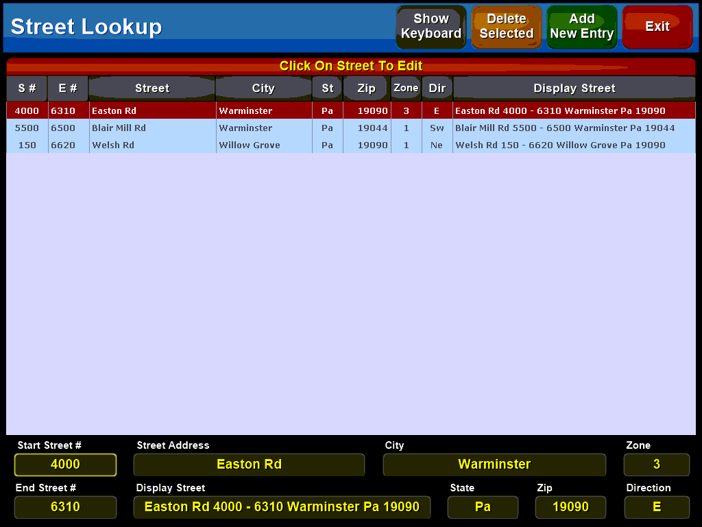
To edit a street simply click on it to open the street specific dialog boxes:

The Start and End Street # entries allow you to map the portion of the street that is in your delivery area. If a street runs for several miles throughout your area you would only map the portion within your delivery radius. when entering a new customer the system will check if the address is within the starting and ending numbers and assign the proper zone and City, State and zip information.
Use  to bring up an onscreen keyboard to assist in entering the street information.
Additionally you can use the  button to enter a new street or the
  button to delete a street from the system.